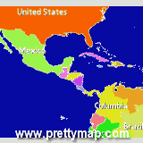
View maps of Earth and other planets with PrettyMap! See current day and night areas, learn geography with the quiz, enjoy 3D elevation surfaces, measure distances between locations and create your own maps with special places! PrettyMap lets you view vector and raster maps and images (such as country boundaries, world cities, rivers, satellite photos), search in geographically-referenced data, visualize and analyze spatial information, extend your knowledge, and edit your own simple maps. PrettyMap is a GIS program with the following features:
- support for vector maps (points, lines, areas)
- support for raster maps (terrain elevation and bathymetry, images, symbolic)
- handles multi-attribute data associated with vector map objects
- displays maps of various planets
- all maps are free:
- political: country boundaries with country names, capitals, population sizes, ...
- major cities with names, status, population ranks and classes, ...
- USA states with areas, population sizes, males, females, ...
- major rivers
- elevation data for Earth, Moon, Mars
- satellite photos and images
- lunar mountains, craters and crater chains, seas, lakes, swamps, valleys, ...
- and many more!
- spheral projection
- relief and 3D elevation (DEM) view with vector map overlay
- shows day and night area, computes shadow length and sun/north orientation
- internet connection not required on your PDA
- various color schemes for elevation maps
- user-defined elevation colors
- zoom range from whole planet to meters
- multiple, configurable vector map layers
- data search for vector map databases
- versatile quiz with teacher mode for vector map databases
- bar charts and color-by option for numeric features in vector map databases
- distance measurement
- integrated user-defined locations (Points Of Interest) editor, stores notes and values
- sessions to quickly save/restore program state
- adjustable water level